|
Fort Harry Falls Teaser Fort Harry, a Confederate fort, was built in 1862 by Cherokee Confederate troops and white Highlanders. The fort was to prevent Federal forces from Knoxville and East Tennessee from destroying the Alum Cave Mines on the side of Mount LeConte which provided gunpowder and chemicals for the Confederacy. Built on a bluff. Fort Harry looked straight down on the Old Indian Road leading to Indian Gap, the Oconaluftee Turnpike and Western North Carolina. The Federal troops did raid Western North Carolina but it was by way of Newport, Asbury Trail, Mount Sterling, Cataloochee, Waynesville and Oconalufree. Fort Harry was at the 3300-foot elevation of the Great Smoky Mountains eight miles south of Gatlinburg, TN. The Confederate army confiscated the Sugarlands farm of Steve Cole for Fort Harry. Cole Creek is nearby. Fort Harry was on a ridge on West Prong Little Pigeon River .03 mile south of today's intersection of Road Prong and Walker Camp Prong. The fort site is on ^ewfound Gap Road 6.0 miles south of the Sugarlands Visitor Center at Gatlinburg dnd 0.5 miles north of the first tunnel at the Chimney Tops parking area on Newfound Gap Road. It sat in the "V" of the mountain gateway between the Chimney Tops on the south and Mount LeConte on the north. The fort was 100 feet by 100 feet. It sat 50 feet above the Indian Gap Road and the West Prong Little Pigeon River. The two outside walls were upright, pointed logs, appearing like two rows of sharpened pencils. The outside row was 10 foot, the inside 16. The log construction made it easy for the Federal forces to burn the fort in 1864. There were eight guard towers. The double wagon gate was unique—the inside gate would not open until the outside gate was shut and secured. Soldiers died of pneumonia as the barracks was damp and not heated. The 300 soldiers had to take three eight-hour shifts to find beds. Five troops slept in the kitchen. Cooking was over an open fireplace. A box spring was the only source of water. Cherokee Tribal Historian Carl Lambert, 77, stated in an interview with the author that Fort Harry was named for Col. William H. Thomas, the white chief of the Cherokee. (The word "harry" is synonymous with "Army commander attacking with organized forces.") In 1862 during the Civil War, Confederate President Jefferson Davis authorized Thomas to organize 1400 troops into the Thomas' Confederate Legion of Cherokee Indians and Mountaineers. Some 500 of these Confederate troops were from East Tennessee, a Union stronghold. Thomas Divide, 3310 feet, on the south side of the Great Smoky Mountains, also is named for Col. Thomas. The unique name for the fort was suggested by Robert Collins, Thomas' life long friend. Collins was in charge of building the fort and improving the 30-year-old ill-kept overmountain road and maintaining Oconaluftee Turnpike (Thomas Road) and Indian Gap Road over the Smokies. Collins first built the road between Webster, NC and Sevierville, TN in 1838. Due to his age, 56, Collins worked as a civilian in charge of 400 Cherokee troops in building Fort Harry. On 9 April 1863, Collins contracted pneumonia due to exposure at Fort Harry and died. Even though the war was going on, Collins' body was carried back over the Smoky Mountains via Indian Gap to Oconaluftee, NC and buried in the Old Beck Cemetery. Mt. Collins, 6188 feet, in the Smokies is named for him. The name is not forgotten, but there are few written references to Fort Harry. There are Fort Harry Confederate Cherokee Burial Ground, Fort Harry Falls, Fort Harry Ford and Fort Harry Bridge. In old Sevier County, TN deeds there are mentions of the ford and bridge. There is a 1930 photograph of Fort Harry Falls by A. G. (Dutch) Roth. Little-known Fort Harry Confederate Burial Ground is on the Road Prong Trail (Indian Gap Road) 0.8 miles south of the Chimney Tops Parking Area on Newfound Gap Road. Across the trail from the burial ground is the site of the Goldie Brown Possession Cabin for Champion Lumber Co. mentioned in many publications. None of the thousands of hikers today en route to the Chimney Tops are aware of Fort Harry Confederate Burial Grounds. There is a well-worn path to the arrowhead marker for Fort Harry Burial Ground. Some 39 soldiers and 100 Cherokee civilians are buried there. Most of the soldiers were victims of measles, mumps and exposure. A crude shaped 3x4 foot stone arrowhead marks the burial of those dying between 1862-1864. The symbols on the stone have weathered away. The Cherokee soldiers' graves are in three neat rows. There are no stones or any identification. The graves can only be found by the ancient art of dowsing. The graves of the Cherokee families are helter skelter on the hill sloping to the waters of Road Prong. The Cherokee were known for taking their entire families to battle with them. Thus the explanation of the family graves. Aden Carver, 16, of Oconaluftee, NC was just old enough to enlist in Thomas' Legion, But the Confederates needed young Carver to operate the gristmill at Oconaluftee and carry the cornmeal 10 miles to the 300 troops at Fort Harry. He did just that for the entire life of Fort Harry. Carver was a member of the Home Guard, which permitted him to draw an $8 a month pension. Carver (23 May 1844 - 24 June 1945) was Swain County's oldest citizen, living to be 101. He built watermills his entire life in Sevier County, TN and Swain County, NC. Hiram C. Wilburn, acting first historian of the Great Smoky Mountains National Park, quoted Carver as saying "Beginning in 1862,1 was inside Fort Harry many times during its occupation. My daddy, Israel Carver, and me salvaged Fort Harry in 1864 after the camp was destroyed by Federal forces." On 2-3 November 1937, Carver walked over the entire Indian Gap Road south of Gatlinburg revealing stories about Fort Harry, Indian Grave Flats and the Civil War. The Fort Harry Confederate Cherokee Burial was not mentioned The Cherokee were not written-record keepers. Legends were passed on from generation to generation by word of mouth. Most of their history has been lost forever. Fort Harry history was provided by R. Glenn Cardwell that a large Cherokee burial ground was located across Road Prong Trail from the Goldie Brown possession cabin at Beech Flats. The Indian Grave Flats Burial Ground is located near an unnamed ford on the Road Prong (Old Indian Gap Road) 2.0 miles north of Indian Gap NC-TN and so identified on the Clingmans Dome quad map. Indian Grave Flats is 0.8 mile south of Beech Flats and Fort Harry Confederate Cherokee Burial Grounds. Carson Brewer, "the hiker's hiker," mellowed columnist for The Knoxville News-Sentinel, came the closest to identifying the Fort Harry Confederate Cherokee Burial.' He wrote "A little more than a mile from the beginning of the trail is Indian Grave Flats, where one of Col. Thomas' men were buried." He had actually discovered the Fort Harry Confederate Cherokee Burial Grounds thinking it was the Indian Grave Flats. Carson Brewer, Paul Fink, Glenn Cardwell, Dwight McCarter, and Carl G. Lambert discovered the Fort Harry Confederate Indian Burial. Pete Prince only confirmed their findings as a historian and Regional Master Dowser. Prince's find was enhanced by other dowsers, Inez Adams, who was born in Cades Cove, her husband Earl Adams, Knoxville artist and award-winning photographer Terri L. Swaggerty, Asheville teacher Lois Autrey Maddox, and R. Glenn Cardwell, retired GSMNP supervisory ranger, president of the Smoky Mountain Historical Society and mayor of Pittman Center, TN Indian Grave Flats marks the burial of an unwilling Cherokee scout who in 1864 disobeyed the Union soldiers. He was dragged 10 miles from Oconaluftee to the Indian Gap Road, shot and left to die. He was buried on the spot by Confederate troops. Paul M. Fink, author of That's Why They Call It...The Names and Lore of the Great Smokies, and a member of the Tennessee Nomenclature Committee, wrote in 1956 story: "Echoes of the Civil War are heard in two names near the Chimney Tops. In 1862, Col. Wm. H. Thomas and his combined Confederate force of Indians and whites, made camp a short distance above the Chimneys Camp Ground (today a national park picnic ground), while building a road to develop the mineral resources of the Alum Cave. To guard against surprise attack from Federal troops down the valley, earthworks were thrown up and guards posted. The spot was christened Fort Harry, for whom unknown, and the river crossing nearby Fort Harry Ford. According to Fink, "In 1864, Federal troops made a raid into the Cherokee country by way of Newport, Mt. Sterling and Waynesville. Fought to a draw near Cherokee, they retreated across the mountain through Indian Gap. Several Indians had been captured and were taken along as guides. One, unwilling or unable to go further, was shot about two miles below the gap and left to die. "Pursuing Confederate forces found him, cared for him until death and buried him, the spot taking the name Indian Grave Flats." Our Adventure today begins early morning, No one seems to be in town or visiting the park today...Excellent! Amanda and I parked at the pull off, and off we were on the straight up climb to the falls today. After only minutes I thought I prepared everything but didn't realize I put on the wrong hiking shoes, this made the hike up especially difficult for me and at times thought I needed to turn around. We got up to the Falls in no time and enjoyed the views for a few moments, looking back you can see chimney tops. and the spot approx where Albert "Dutch" Roth sat in his famous photograph. We were feeling adventurous and did a EVP session while we were there, asking questions related to the history of the fort nearby. Figured the running water of the falls would be a great place for this. Recorded for a total of five minutes and set off down to explore the lower area for signs of the Fort which we know there are no remnants but hopeful us are just wanting to know where it sat. We got down to lower elevation really fast and saw that a U.S. Park Ranger suv was pulling in, the gentleman exited the vehicle and appeared to tighten their laces. Within a few moments we ran into Ranger J. Duckett and his accomplice, he asked " Have you been to the falls yet? " and I replied " Yes we have.." he then in return asked if any water was falling from overhead, I explained that it was still strickling down. I asked Ranger Duckett about the history of the Fort and where it sat exactly and he said he had thought it was right where the parking area was. At the time I thought he was ignorant and wrong but then I realized in my research the old fort sat 50ft above the old Indian Gap Rd, which would be about 50ft below present Newfound Gap. Voila! sad to think alot of this history was dug up and excavated and removed as fill dirt etc who knows how many artifacts lie in those woods, as long as it's a National Park we may never know. 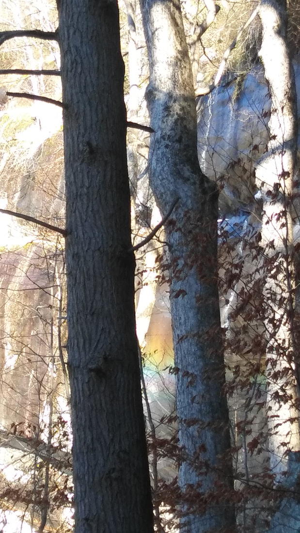 Rainbow between trees. 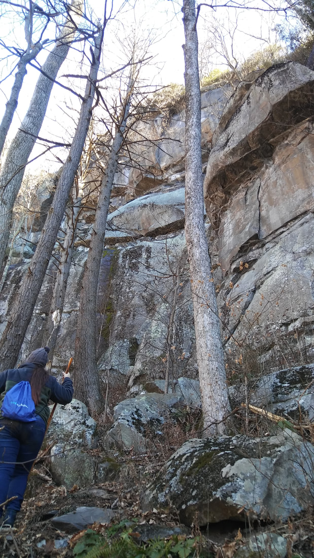 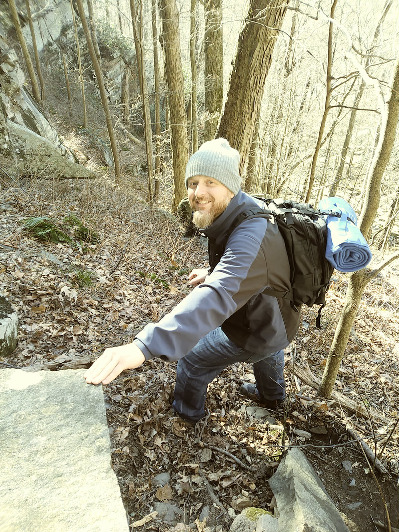
0 Comments
Leave a Reply. |
MiketheHikingGuide
Just an explorer searching for his next adventure Archives
January 2019
Categories |
 RSS Feed
